Join Our Newsletter
Visit Herefordshire App Blog Contact Us
Get Listed
© 2026 Herefordshire County BID

Marcle Ridge and Woolhope Dome

Image
roasts & rambles
Map Marker Illustration
Woolhope
Wellies Illustration
5.6 miles
Intro

The unique local geology has created a soft rolling countryside around Marcle Ridge, but as you gradually ascend the ridge you will see way beyond this to the dramatic Black Mountains in one direction and to the Malvern Hills in the opposite direction. 

Don't Miss

Created about 250 million years ago, the Woolhope Dome has a unique geological background and for the most part, its eroded hills and valleys have not been intensively farmed.  As a consequence, the Dome is a rich mosaic of ancient oak and mixed woodlands, species-rich hedgerows, wildflower meadows, traditional orchards and streams, all supporting a wealth of wildlife.  Look for the fossils formed in the coral seas 400 million years ago.


A thank you to 'Walkers are Welcome Ross' for sharing this route with Visit Herefordshire.

Hiking Trail recommended route Hiking Trail  · Herefordshire

Marcle Ridge and Woolhope Dome

Logo Visit Herefordshire
Responsible for this content
Visit Herefordshire Verified partner 
  • Climb Marcle Ridge and explore Woolhope Dome, where rolling hills and ancient geology shape some of the county’s finest views.
    Climb Marcle Ridge and explore Woolhope Dome, where rolling hills and ancient geology shape some of the county’s finest views.
    Photo: Visit Herefordshire, Visit Herefordshire

Selected alternatives for you
    The unique local geology has created a soft rolling countryside around Marcle Ridge, but as you gradually ascend the ridge you will see way beyond this to the dramatic Black Mountains in one direction and to the Malvern Hills in the opposite direction. 
    moderate
    Distance 5.7 mi
    2:30 h
    456 ft
    453 ft
    741 ft
    285 ft
    Created about 250 million years ago, the Woolhope Dome has a unique geological background and for the most part, its eroded hills and valleys have not been intensively farmed.  As a consequence, the Dome is a rich mosaic of ancient oak and mixed woodlands, species-rich hedgerows, wildflower meadows, traditional orchards and streams, all supporting a wealth of wildlife.  Look for the fossils formed in the coral seas 400 million years ago.
    Logo Visit Herefordshire
    Responsible for this content
    Visit Herefordshire  Verified partner 
    Difficulty
    moderate
    Overall difficulty
    moderate

    Derived from the technical difficulty and the stamina requirements.

    Experience
    Landscape
    Highest point
    741 ft
    Lowest point
    285 ft
    Best time of year
    Jan
    Feb
    Mar
    Apr
    May
    Jun
    Jul
    Aug
    Sep
    Oct
    Nov
    Dec

    Track types

    Asphalt 27.71%Dirt road 2.29%Forested/wild trail 17.42%Path 52.56%
    Asphalt
    1.6 mi
    Dirt road
    692 ft
    Forested/wild trail
    1 mi
    Path
    3 mi
    Show elevation profile

    Roadbook

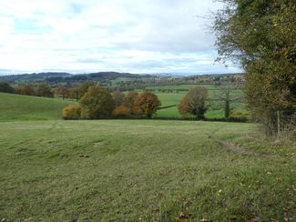
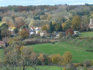
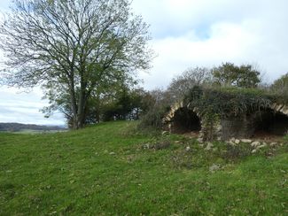
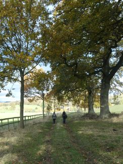
    Starting at the Butchers Arms car park, go right for 250m and turn right up the driveway of Lenacre Ford and through the gate into the large field beyond.  Keep right, passing Poplar Cottage and turn left on reaching a track.  Follow the steep track up, past Beans Butts Wood and into a rolling field with views behind you to Woolhope village.  Go directly up the field passing close to the lime kilns (producing lime  circa 1800 to sweeten the land, in building and to remove the hair from skins before leather tanning).  For a rest and a view, detour slightly right to the two benches.  Otherwise continue straight up to leave the field at a stile on the sharp ridge and then down through the edge of Busland Wood (an ancient woodland).  Leaving the wood keep left to cross a perfectly formed U-shaped valley and up to the road running along the Marcle Ridge at Hoopers Oak.

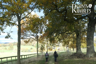
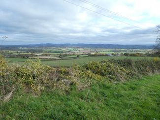
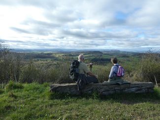
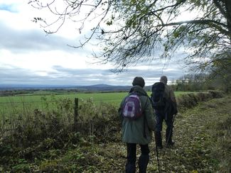
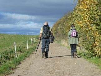
    Follow the road to the right, with views soon opening up to the Malvern Hills, the Cotswolds and May Hill.  After 0.5 ml leave the road and climb the steps into a field.  Keep left with Johns Wood on your right for another 0.5 ml, gently ascending to the summit of the ridge and then right through a steel field gate to a rough wooden bench with the most wonderful views.  Continue along the footpath between the two hedgerows for 0.6 ml passing the 540ft high TV transmitting mast and then leave the path down some wooden steps to a track (if the path between the two hedgerows is overgrown it is easier to step back through the field gate outside the hedgerows and follow the field edge).     

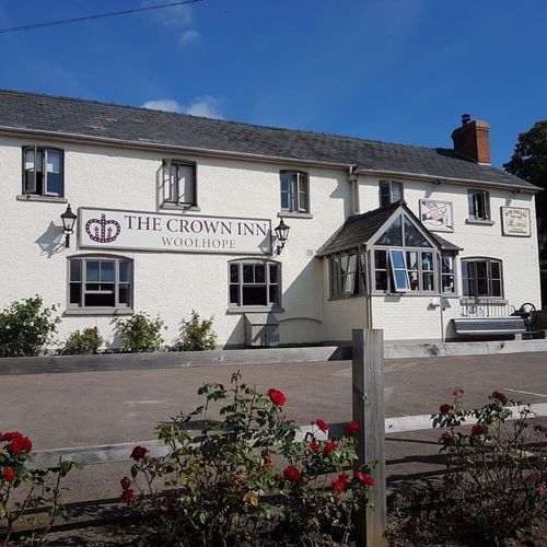
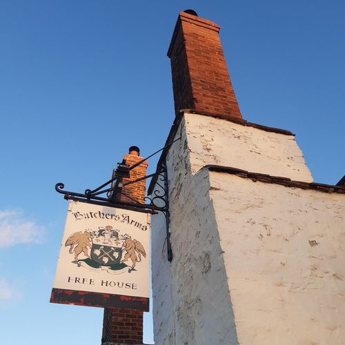
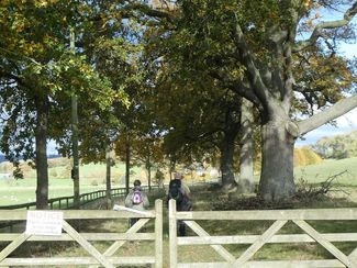
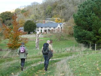
    Turn right and go steeply down hill on a stony track and at the bottom turn right onto a track through a field.  Follow the track to Sapness House, going right and then sharp left onto another track.  Go through the wooden field gate on the right and follow the pretty avenue of trees to Hyde Farm, turn sharp left around a barn to continue on another track.  After 0.5 ml cross a stile on the right, going half left across the field and over a stile into an apple orchard.  Note the waymarker on the stile to guide you through the orchard and continue in the same direction through fields to join the road just east of Woolhope.  Go right along the road to the car park and then relax in the Butchers Arms.

    Rest stop
    Tip
    Nearby
    Top Partner
    Waypoint
    Start point
    End point
    Low point
    High point
    Forecast
    Today {low} to {high} and {precipitation} of {precipitation_type}
    show {x} more
    Photo
    Video
    The Crown at Woolhope
    Woolhope Church - St. George's
    The Butchers Arms

    Public transport

    Get Timetable to destination

    to
    Marcle Ridge and Woolhope Dome

    Coordinates

    OS Grid
    SO 61745 35817
    DD
    52.019450, -2.558871
    DMS
    52°01'10.0"N 2°33'31.9"W
    UTM
    30U 530270 5763293
    w3w 
    ///waxer.duty.steepest
    Get there by train, car, bike, or on foot!

    Similar routes nearby

    • Blossom Walk: Woolhope Circular
    • Marcle Ridge to Ross-on-wye
    • Blossom Walk: Westons Cider Circular
    • Eastnor and the Malverns: Ledbury to Colwall (return by train)
    • Ramble by the Wye
     These suggestions were generated by our system
    Difficulty
    moderate
    Overall difficulty
    moderate

    Derived from the technical difficulty and the stamina requirements.

    Distance
    5.7 mi
    Duration
    2:30 h
    Ascent
    456 ft
    Descent
    453 ft
    Highest point
    741 ft
    Lowest point
    285 ft
    Scenic Family-friendly Flora Fauna Round trip

    Statistics

    • Content
    • Show images Hide images
    Features
    2D 3D
    Maps and trails
    Nothing selected - click and drag in the elevation profile to zoom
    Distance
    Duration
    Ascent
    Descent
    Elevation profile