The South Cider Circuit: The Redstreak
Image

58.7 miles
Intro
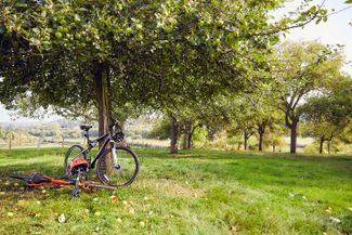
The ancient apple and pear orchards of southern Herefordshire, some of them well over two centuries old, are lovingly harvested by local producers to ferment spectacular ciders and perries in traditional and innovative styles.
Touring this 59-mile circular route will take you along shady backroads and the River Wye, as you visit some of the region’s best cider-makers. Travel from Hereford to Little Dewchurch, Hoarwithy and Ross-on-Wye, then onwards to Much Marcle, Ledbury and Bromyard, finishing back in the county city.
Don't Miss
Producers featured:
Highlights include:
- Making your way over Foy Suspension Footbridge
- Pausing for a picnic in a shady spot on the Wye
- Admiring Hoarwithy's Italianate-style church
Downloadable Guide
Image


