The Watkins Way by Bike
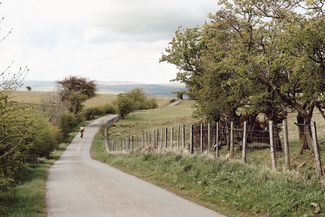


Cycling the 106-mile Watkins Way over five days lets you enjoy the glorious views, plentiful historical sites and the challenge of the undulating landscape, without exhausting yourself. The middling pace of pedal power – fast enough to get around but slow enough to see the sights – is perfect for Herefordshire. Or take the challenge up a gear and tackle the route over 3 days. Being one of the most rural parts of the UK, it’s sensible to pack sustenance for the road and plenty of spare inner tubes just in case.

The Watkins Way - 106 Miles Cycle

Visit Herefordshire Verified partner
-
 Statue of Sir Edward Elgar Hereford CathedralPhoto: Trish Henderson, Visit Herefordshire
Wind through the untouched Golden Valley, into the shadow of the Black Mountains and on to the county's picture-perfect black and white villages. Visit the lost castles, secluded churches, early hillforts and prehistoric stones which sparked Watkins' revelation. The Watkins Way guide is free to download and features the best local places to stop along the way.
Author’s recommendation
Visit Herefordshire Verified partner
Derived from the technical difficulty and the stamina requirements.
Track types
Rest stops
The Riverside at AymestreyButford Organic Cider & Perry
The New Inn
Tips and suggestions
PLANNING YOUR TRIPCycling the 106-mile Watkins Way over five days lets you enjoy the glorious views, plentiful historical sites and the challenge of the undulating landscape, without exhausting yourself. The middling pace of pedal power – fast enough to get around but slow enough to see the sights – is perfect for Herefordshire.
1. Woolhope Church, HR1 4QR
The start of a few days of beautiful riding is appropriately peaceful and picturesque, with the route beginning at Woolhope Church. If you’re cycling from Hereford, expect a significant climb to Woolhope itself – but you earn it back in the other direction. It’s worth getting in the mindset of expecting a climb around every corner, too. An early highlight is crossing the River Wye, where you can pause to appreciate the vista. This first section sets the tone for much of the route: quiet roads and near-constant ups and downs.
2. Dinedor Hill, HR2 6PD - 7.95miles
Dinedor Hill is one of a few points on the trip where you come briefly off the GPS route, which you can download and display on your phone here. Follow the route as normal, but continue beyond it just a bit further to the top of the hill and the very rewarding views. As with some of the other stops and sights on the route, it involves a very slight detour off the road, but one well worth it. If you want to investigate the Iron Age hill fort that sits at the top, dismount and explore on foot.
3. Kilpeck Church & Castle, HR2 9DN - 9.63 miles
After carefully making your way back down the steep Dinedor Hill, head south for several miles, passing by another Iron Age hill fort, Aconbury Camp, before taking a hard right towards Kilpeck. Here you’ll find the Kilpeck Inn, home to a very friendly floppy-eared pub dog called Ollie, and a great spot to recharge your batteries with pub grub in the garden. Mere metres away is the elaborately carved Kilpeck Church and the remains of Kilpeck Castle - just lock your bike in the pub garden and head over on foot. The Kilpeck Inn also has four luxury rooms if you’re looking for a place to stay the night.
4. Dore Abbey, HR2 0AA - 5.08 miles
If Kilpeck whet your appetite for history and impressively grand old churches, you haven’t got long to wait before one of the highlights of the trip, Dore Abbey, which is about five miles away via Wormbridge, passing by Gilbert’s Hill Wood. A very short detour off the road after crossing the River Dore brings you to a churchyard, with the abbey itself set towards the back, imposing and proud. There are headstones hundreds of years old in the churchyard; look out for Thomas Jackson’s, inscribed with an apt poem on the passage of time in such a historical setting: Pass a few swiftly fleeting years, And all that now in bodies live, Shall quit like me, the vale of tears, Their righteous sentence to receive.
5. Clodock Church, HR2 0PD - 5.13 miles
A series of very sharp climbs and descents – amounting to nearly 700ft of elevation gain in about five miles of riding – take you to Longtown, to which you’ll return after taking a short detour to get to St Clydawg Church in Clodock, which dates back to the 6th century. The name hints at a strong Welsh influence; this section of the route is the closest to the Welsh border.
The Riverside at Aymestrey
Butford Organic Cider & Perry
The New Inn
Orgasmic Cider Company
Old Chapel Gallery
The New Inn
Legges Copper Kettle
Brockington Tearooms
The Pandy Inn
Red Lion Hotel - Bredwardine
St Peter's Church, Peterchurch
Arthur's Stone
Snodhill Castle
St Faith's Church Dorstone
Food For Thought
Dore Abbey
Black Mountains Botanicals Gin Making Experience
Longtown Castle
Skirrid Studio & Gallery
Hopes of Longtown
Crown Inn Longtown Herefordshire
The Bridge Inn, Michaelchurch Escley
The New Strand
The Riverside at Aymestrey
National Trust Croft Castle
Croft Church
Wigmore Castle
The Castle Inn, Wigmore
Tudge Meats
Shobdon Church
The Kilpeck Inn
Kilpeck Church
Riverside Bar & Eatery
Haugh Woods
Richards Castle St Bartholomew Church & 11th Century Castle
Public transport
Get Timetable to destination
Coordinates
Equipment
Bring binoculars to make the most of the views and to help visualise the ley lines running between key points, such as hilltops. Being one of the most rural parts of the UK, it’s sensible to pack sustenance for the road and plenty of spare inner tubes just in case. Please note that the roads to our remote places tend to be narrow country lanes, so take your time and enjoy the journey.Derived from the technical difficulty and the stamina requirements.
Statistics
- Content
- Show images Hide images