Black & White Villages Walk: Eardisland to Shobdon Arches
Image

7.6 miles
Intro
Roam rolling farmland to discover a winsome black-and-white village, a medieval folly and one of England’s most remarkable rococo churches.
Don't Miss
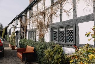
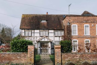
Eardisland is arguably Herefordshire’s prettiest village, with timber-framed houses, a moated castle mound and an impressive medieval church. Shobdon Arches, now a spectacular hilltop folly, were removed from the nearby 12th-century church when it was revamped in unusual rococo style six centuries later.
Image


Gallery
Image

Image

Image
Image

The Manor House, Eardisland


Hollyhocks, Eardisland
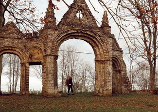
Shobdon Arches