Join Our Newsletter
Visit Herefordshire Radio
Blog Contact Us
Get Listed
© 2026 Herefordshire County BID

Black & White Villages Walk: Weobley to Burton Hill

Image
The Throne, Weobley
Wellies Illustration
5.5 miles
Intro

Traverse peaceful fields and climb into a mesmerising hilltop forest, discovering a glorious Elizabethan manor and the remains of Weobley’s 13th-century ring-and-bailey fortification.

Don't Miss

The multi-gabled black-and-white Elizabethan manor know as The Ley sits amid farmland southwest of Weobley. Listen for woodpeckers and watch for skittish families of roe deer amid the forest on Burton Hill. Then roam the evocative remains of Weobley’s medieval castle.

Hiking Trailrecommended routeHiking Trail  · Herefordshire

Black & White Villages Walk: Weobley to Burton Hill

LogoVisit Herefordshire
Responsible for this content
Visit Herefordshire Verified partner 
  • Walk the Weobley to Burton Hill Trail for countryside views and a picturesque finish in one of Herefordshire’s prettiest black-and-white villages.
    Walk the Weobley to Burton Hill Trail for countryside views and a picturesque finish in one of Herefordshire’s prettiest black-and-white villages.
    Photo: Photopia Photography, Visit Herefordshire

Selected alternatives for you
    Traverse peaceful fields and climb into a mesmerising hilltop forest, discovering a glorious Elizabethan manor and the remains of Weobley’s 13th-century ring-and-bailey fortification.
    moderate
    Distance 5.6 mi
    2:30 h
    630 ft
    630 ft
    945 ft
    315 ft
    LogoVisit Herefordshire
    Responsible for this content
    Visit Herefordshire  Verified partner 
    Difficulty
    moderate
    Overall difficulty
    moderate

    Derived from the technical difficulty and the stamina requirements.

    Experience
    Landscape
    Highest point
    945 ft
    Lowest point
    315 ft
    Best time of year
    Jan
    Feb
    Mar
    Apr
    May
    Jun
    Jul
    Aug
    Sep
    Oct
    Nov
    Dec

    Track types

    Forested/wild trail 31.51%Path 51.95%Road 2.66%Unknown 13.86%
    Forested/wild trail
    1.8 mi
    Path
    2.9 mi
    Road
    791 ft
    Unknown
    0.8 mi
    Show elevation profile

    Roadbook

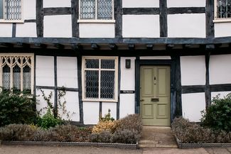
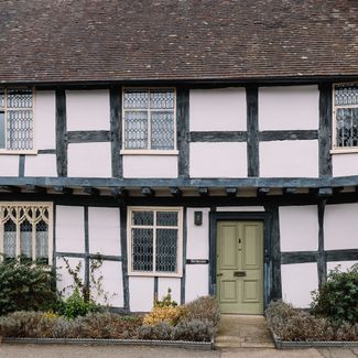
    Facing the Rose Garden in Weobley’s old medieval square, with your back to Ye Olde Salutation Inn, turn left down High Street and cross Back Lane, turning right then immediately left alongside the imposing black-and-white Marlbrook House with its first-floor jetty. Follow what seems to be a driveway into a farmyard, going through a series of gates to reach a field with a hedge on your right; when a stile appears in the hedge, turn left to cross the field, and continue through further gates to cross fields and a small meadow, mounting a style and emerging onto a tarmac road in front of The Ley, a magnificent timber-framed house built in 1589.

    Turn right and cross the small green diagonally, past metal sculptures and an old cider millstone, and a farmyard; follow yellow arrows through large metal gates past farm buildings to reach a concrete track that, when the hard surface runs out, becomes a grassy path in a field running alongside a hedge to your left; enjoy views ahead to the hills on the Welsh border. Cross a small footbridge and veer slightly right across a field, continuing through two fields to reach a T-junction at the edge of a copse. Turn right, soon following the path round to the left, still alongside the copse – this stretch can be muddy. Emerge into a field, turning left and tracing the edge of the field, veering right at the end into the next field; in the far corner, go through the gap left and climb to the road.

    Turn left, shortly taking the signposted path right climbing steeply to a drive and continuing uphill to reach a path ascending into the woods. At the forestry track, turn left and look for a narrow signed path running steeply uphill to the right, crossing another forestry trail to reach a wider track ahead, quickly levelling out. Pass a trig point marking the top of Burton Hill, drinking in the peace of this shady, dappled woodland. Before long, reach a junction of tracks; take the narrow path signed sharp left, descending steeply to a wide track, where you turn right to exit the woods. Before long, the slender spire of Weobley Church comes into view ahead, with deciduous woodland capping the hills to your right.

    Follow the trail round to the left, joining a gravel track that veers right to a T-junction; turn left, through a gate and diagonally right across a field, aiming for the left-hand edge of a high brick wall. Emerge through a gate alongside the wall onto a track, then into a field; at the end, turn left and go through a gate onto a path leading directly towards the church.

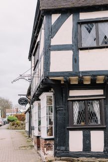
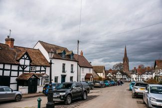
    Continue through fields and across a meadow guarded by a huge old oak, crossing a kissing gate to reach the remains of the medieval ring-and-bailey fortification built 900 years ago. Emerge through a gate to return to Weobley’s central square, where you’ll find a host of options for toasting your walk – a pint at Ye Olde Salutation, perhaps, or coffee and cake at Jules or The Green Bean Café.

    Rest stop
    Tip
    Nearby
    Top Partner
    Waypoint
    Start point
    End point
    Low point
    High point
    Forecast
    Today {low} to {high} and {precipitation} of {precipitation_type}
    show {x} more
    Photo
    Video
    Jules Restaurant
    Ye Olde Salutation Inn
    Green Bean Cafe

    Public transport

    Get Timetable to destination

    to
    Black & White Villages Walk: Weobley to Burton Hill

    Coordinates

    OS Grid
    SO 40270 51542
    DD
    52.158908, -2.874545
    DMS
    52°09'32.1"N 2°52'28.4"W
    UTM
    30U 508582 5778720
    w3w 
    ///loaded.detriment.roofed
    Get there by train, car, bike, or on foot!

    Similar routes nearby

    • Weobley Trail
    • Weobley to Pembridge
    • Black & White Villages Walk: Eardisland to Shobdon Arches
    • Whittern Farms Trail (Private Property - guests only)
    • Titley Round
     These suggestions were generated by our system
    Difficulty
    moderate
    Overall difficulty
    moderate

    Derived from the technical difficulty and the stamina requirements.

    Distance
    5.6 mi
    Duration
    2:30 h
    Ascent
    630 ft
    Descent
    630 ft
    Highest point
    945 ft
    Lowest point
    315 ft
    Round trip Scenic Refreshment stops available Family-friendly Dog-friendly Suitable for strollers

    Statistics

    • Content
    • Show images Hide images
    Features
    2D 3D
    Maps and trails
    Nothing selected - click and drag in the elevation profile to zoom
    Distance
    Duration
    Ascent
    Descent
    Elevation profile