Kington to Lingen
Image


Kington

12.2 miles
Intro
This wonderfully scenic part of the trail includes spots associated with Byron’s affair with Herefordshire noblewoman Jane Harley in 1812/1813. The path first follows the lush banks of the River Arrow via Titley Junction Station, now a small private railway where steam engines occasionally fire up. Titley Pool, is a 22-acre ‘kettle hole’ lake and a Site of Special Scientific Interest. Accessed from a small gate by the trail, it is home to the brightly plumed great crested grebe and other species.
Image


Image

Image

Image
Image

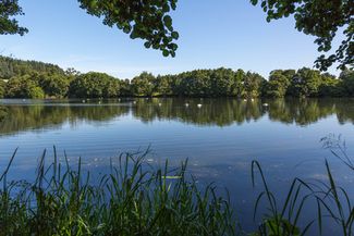
Titley Pool © Bob Langridge

Great Crested Grebe

Kington

Eardisley