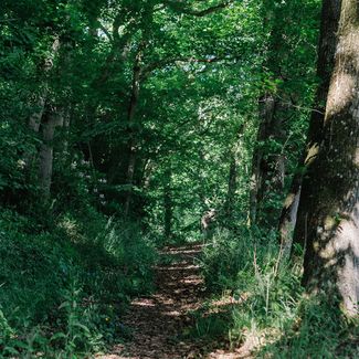
Deep hollow ways cut through Whitney Wood, telling of past stone quarrying, timber felling and charcoal-making.
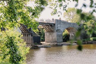
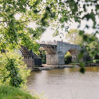
A woodman once lived In the middle of this large wood, in the now ruined cottage known as the ‘Vulture’s Nest’. The trail briefly follows the track bed of the former Hereford, Hay & Brecon Railway (1864-1964) passing the former Whitney Station, now a sawmill. Continue along a hollow way, a section of an ancient north-south route from the Wye Valley. All around lies a wildlife-friendly patchwork of woods and watery dingles, including a species-rich local nature reserve, home to pied flycatchers, bats and the rare, white-clawed crayfish.
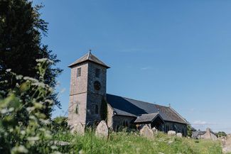
The 12th-century Church of St. Mary, Brilley, was long associated with a superstitious custom. Every corpse for burial was first carried three times around ‘the funeral stone,’ the stump of a medieval stone cross, beyond the gate. Mourners believed this ritual ensured the spirit of the deceased went to heaven.
The trail follows a former carriage drive, now a pleasant green bridleway, through Eardisley Park, past the 18th-century house, restored after a devastating fire. Its history of a long-running family legal dispute is said to have inspired Charles Dickens’s Bleak House.
Eardisley’s Church of St. Mary Magdalene, houses a renowned font, the work of the Herefordshire School of Romanesque Sculpture, bearing a dramatic depiction of Christ’s Harrowing of Hell. Further along the trail stands a giant - the Eardisley Great Oak - a hollow but evidently thriving tree of about 900 years old.
The path then goes through Upper Welson Marsh Nature Reserve, alive with marshland flora, birds, butterflies and frogs. Along the trail to Kington wildflowers flourish in stretches of unimproved grassland, habitat for small mammals. Look to the skies for circling red kites.