The Mortimer Trail
Image


Ludlow

29.7 miles
Intro
This peaceful landscape in the north of Herefordshire was once dominated by the powerful Mortimer family. From the Norman Conquest to the Tudor Landscape the family and their castles featured centrally in battles against the Welsh, in conquests in Ireland, in kingmaking and breaking as well as in the Wars of the Roses.
The Mortimer Trail explores this dramatic legacy over 30 miles, following a succession of hills, ridges and valleys between Kington and Ludlow. Sleepy villages, shady woods and sparkling rivers dot the route, which feature superb vistas.
Don't Miss
- Wandering through wonderful woods, ancient & modern
- Roaming around dramatic hill-forts & imposing castle ruins
- Pausing at meandering rivers teeming with wildlife
- Soaking up the superb vistas
- Passing through pretty villages & farmsteads
- Unparalleled peace & quiet
Image


Image

Image

Image

Image
Image

Image

Image

Image


Wigmore Castle

Kingfishers can be spotted along the rivers

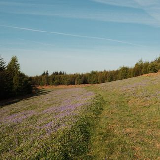
Bluebells at High Vinalls

Mortimer Forest
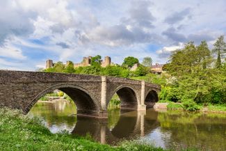
Dinham Bridge into Ludlow

Kington
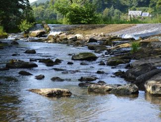
The River by The Riverside Aymestry