Join Our Newsletter
Visit Herefordshire App Blog Contact Us
Get Listed
© 2026 Herefordshire County BID

Twin Valley Ley Line Trail

Image
The Cats Back
Wellies Illustration
44.0 miles
Intro

A modern pilgrim route uncovering wild landscapes & ancient landmarks. Journey along the 44 mile/71 km walking trail which celebrates the discovery of ley lines as it winds its scenic way through two river valleys to lost castles, remote churches, sacred stones and spectacular summits.

On June 30 1921 Alfred Watkins had an extraordinary revelation. As he stood on a Herefordshire hillside, it came to him that straight tracks criss-crossed the landscape, connecting ancient and spiritual sites. He christened them ley lines and regarded them as we might imagine a Neolithic Sat Nav – visual lines of sight enabling our ancestors to situate themselves in the landscape and navigate through it. Read more about the background to the Trail here.

Don't Miss

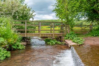
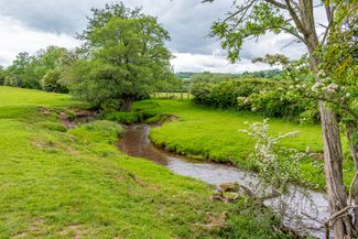
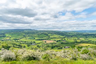
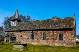
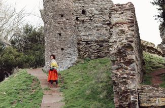
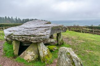
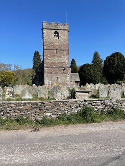
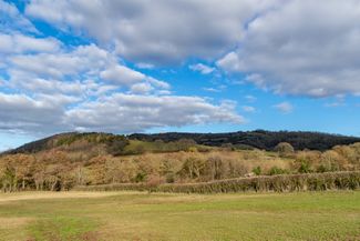
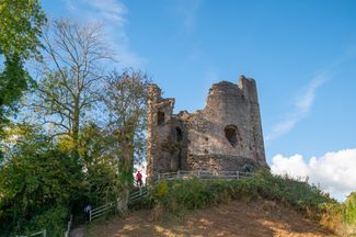
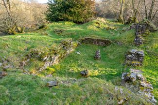
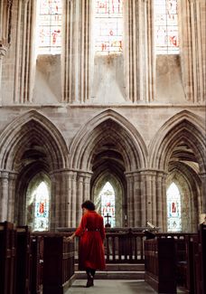
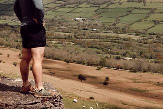
Sacred stones, spiritual spaces, crumbling castles and once-fierce forts dot this wild, remote landscape. Walk along lush river valleys, climb peaks in the Black Mountains and discover the birthplace of two rivers -  the Dore and the Monnow. 

Hiking Trail recommended route Hiking Trail  · Central England and the Midlands

Twin Valley Ley Line Trail

Logo Visit Herefordshire
Responsible for this content
Visit Herefordshire Verified partner 
  • Snodhill Castle
    Snodhill Castle
    Photo: Naomi Moyo-Wilson, Visit Herefordshire

Selected alternatives for you
    A modern pilgrim route uncovering wild landscapes & ancient landmarks. Journey along the 44-mile (71km) walking trail, which celebrates the discovery of ley lines, as it winds its scenic way through two river valleys to lost castles, remote churches, sacred stones, and spectacular summits.
    difficult
    Distance 47.9 mi
    21:20 h
    6,325 ft
    6,322 ft
    2,192 ft
    246 ft
    The Twin Valley Ley Line Trail delves deep into Herefordshire's history and untouched landscapes. Commemorating the centenary of the discovery of ley lines in the county, it journeys from remote moorland and summits in the Black Mountains to ancient woodland and undulating fields

    A total of 44 miles (71 km) long, it can be completed over three to five days, depending on your pace, or walked as a series of day hikes.

    Stages 1 and 2 are dotted with interesting historical sites, so allow time to linger. Stage 3 is a more remote stretch through dramatic landscape - it is more challenging in terms of distance and terrain. 

    There are a variety of accommodation options, including country pubs, B&Bs, and atmospheric churches, which enable you to plan a trip to suit your requirements, shortening or extending each stage as preferred.

    Highlights include:

    • Climbing to peaks in the Black Mountains
    • Visiting the highest of all monastic sites in England
    • Peeking into tiny churches, packed with character and history
    • Trekking to the heights where the Rivers Dore & Monnow are born
    • Revelling in the stunning views of the Wye Valley from Merbach Hill's summit
    • Stopping for picnics by pretty streams and waterfalls
    • Wandering through lush, green landscapes & ancient woodland
    • Spying the Exmoor ponies on Ewyas Harold Common
    • Pausing for a pint with the locals at friendly country pubs

    Author’s recommendation

    The leaflet for the route is available here.
    Logo Visit Herefordshire
    Responsible for this content
    Visit Herefordshire  Verified partner 
    Difficulty
    difficult
    Overall difficulty
    difficult

    Derived from the technical difficulty and the stamina requirements.

    Experience
    Landscape
    Highest point
    2192 ft
    Lowest point
    246 ft
    Best time of year
    Jan
    Feb
    Mar
    Apr
    May
    Jun
    Jul
    Aug
    Sep
    Oct
    Nov
    Dec

    Track types

    Asphalt 16.20%Dirt road 0.63%Forested/wild trail 7.21%Path 59.32%Road 7.83%Unknown 8.78%
    Asphalt
    7.8 mi
    Dirt road
    1614 ft
    Forested/wild trail
    3.5 mi
    Path
    28.4 mi
    Road
    3.8 mi
    Unknown
    4.2 mi
    Show elevation profile

    Tips and suggestions

    The Twin Valley Ley Line trail is 44 miles (71 km) long and can be completed over three to five days, depending on your pace, or walked as individual day hikes. Stages 1 and 2 are dotted with interesting historical sites, so you may wish to allow time to linger. Stage 3 is a wilder, more remote stretch through dramatic landscapes and is more challenging in terms of distance and terrain. Please note, there are options to shorten or extend the stages to suit your requirements. For example, staying overnight at Craswall rather than Longtown will shorten Stage 3 by several miles.
    Rest stop
    Tip
    Nearby
    Top Partner
    Waypoint
    Start point
    End point
    Low point
    High point
    Forecast
    Today {low} to {high} and {precipitation} of {precipitation_type}
    show {x} more
    Photo
    Video
    The Pandy Inn
    Discover Herefordshire's Secrets (Illustrated Talks by Penny Platts)
    St Peter's Church, Peterchurch
    Arthur's Stone
    Snodhill Castle
    St Faith's Church Dorstone
    Food For Thought
    St Bartholomew, Vowchurch
    St Mary Magdalene Turnastone
    Granary Cottage Dorstone
    Dore Abbey
    The Temple Bar Inn
    The Garden of the Wind
    Clodock Church
    Longtown Castle
    St Margarets Church
    Rowlestone Farmhouse Ice cream
    St Michaels & All Angels Church, Ewyas Harold
    Walterstone Church
    St Beuno & Peter's Church, Llanveyno
    Drovers Rest Farm - Tables in a Barn & Cocktail Bar
    Drovers Rest Farm - Animal Encounters & Farm Visits
    St Faith, Bacton

    Public transport

    Get Timetable to destination

    to
    Twin Valley Ley Line Trail

    Coordinates

    OS Grid
    SO 31355 41656
    DD
    52.069008, -3.002853
    DMS
    52°04'08.4"N 3°00'10.3"W
    UTM
    30U 499804 5768713
    w3w 
    ///trails.entrusted.covers
    Get there by train, car, bike, or on foot!

    Similar routes nearby

    • Arthur’s Stone & The Golden Valley
    • The Black Hill, Cat's Back
    • Black & White Villages Walk: Weobley to Burton Hill
    • Weobley Trail
    • Weobley to Pembridge
     These suggestions were generated by our system
    Difficulty
    difficult
    Overall difficulty
    difficult

    Derived from the technical difficulty and the stamina requirements.

    Distance
    47.9 mi
    Duration
    21:20 h
    Ascent
    6,325 ft
    Descent
    6,322 ft
    Highest point
    2192 ft
    Lowest point
    246 ft
    Round trip Multi-stage route Scenic Refreshment stops available Cultural/historical interest Geological highlights Flora Fauna

    Statistics

    • Content
    • Show images Hide images
    Features
    2D 3D
    Maps and trails
    Nothing selected - click and drag in the elevation profile to zoom
    Distance
    Duration
    Ascent
    Descent
    Elevation profile