Overall difficulty
easy
Derived from the technical difficulty and the stamina requirements.
Best time of year
Jan
Feb
Mar
Apr
May
Jun
Jul
Aug
Sep
Oct
Nov
Dec
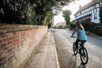
Track types
Asphalt 75.07%Path 0%Road 24.91%
Asphalt
6.9 mi
Path
3 ft
Road
2.3 mi
Rest stops
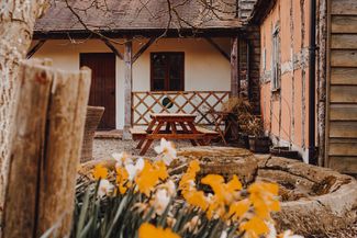
The Cider Barn
The New Inn
Tips and suggestions
1 - Eardisland to Pembridge
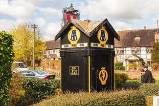
Start at Eardisland’s small central car park, next to the vintage AA box (reputedly the oldest in the country, alongside the Cross Inn). Turn right, then immediately left at Eardisland dovecote between river and millrace, following the lane for three miles beneath mistletoe-baubled oaks to Pembridge, just beyond a riverside picnic spot and conservation area. Cyclist-friendly Pembridge Café (01544 388922) serves fresh-baked goodies, soups, sandwiches, cakes and - on weekend evenings - hand-stretched pizzas. Opposite, the Old Chapel Gallery (oldchapelgallery.co.uk) is packed with high-quality works by British (many local) artists and craftspeople. A path alongside the adjacent Ye Olde Steppes Village Shop (01544 388506) leads to the remarkable detached 13th-century wooden belltower and St Mary’s Church, a huge and fascinating edifice with remnants of medieval wall paintings and a quarter of effigy tombs - spot the leonine dogs (or canine lions) warming the ladies’ feet. Stop for a drink at the cosy, ironically named 17th-century New Inn (01544 388427), offering local ales and game-rich fare; the Market Hall behind is more ancient still - one of several village structures, including Duppa’s Almshouses, that are some five centuries old.
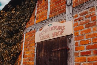
2 - Pembridge to Dunkerton’s Cider Shop & the Cider Barn
Pedal south from the New Inn and Market Hall, across the crossroads at the hamlet of Lower Bearwood, into the heart of cider country. Dunkerton’s Cider Shop (dunkertonscider.co.uk) soon appears on your left; though the cider mill no longer operates here, pick up cider and perry from this rustic shop on Fridays and Saturdays. The 450-year-old Cider Barn is now a sophisticated but friendly café-bar and restaurant (the-cider-barn.co.uk) with a wonderfully warm ambience, open for weekend lunches.
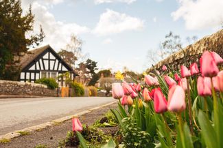
3 - Luntley Court & around
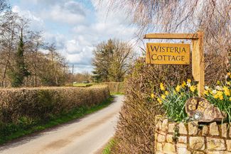
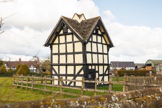
Continue half a mile south to find 17th-century Luntley Court, a picture-book example of a black-and-white Herefordshire manor house, opposite its wood-framed dovecote dating from the same period. Pedal between these beautiful edifices and, just beyond them, continue south, ignoring the turn to your right. Take the first left after another 140m, following the peaceful, winding, undulating farm roads then, after another 1.6 miles, sharp left (north-west). At the next T-junction, turn right. Prepare to climb steadily as the lane snakes east, then north to meet the A44. Cross that road, continuing along the back road past Burton Court, initially delightfully shaded, then between hedges and fields. Emerging onto the busier road, turn right (north) for the short ride back into the centre of Eardisland.
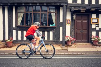
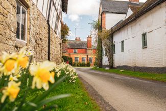
4 - Eardisland
Explore Eardisland, arguably the prettiest of the Black and White settlements, with its gaggle of photogenic cottages straddling the River Arrow and millrace. Head north across the bridge, guarded by a red-brick Georgian dovecote - now a community shop - to find the 14th-century yeoman’s hall known as Staick House, currently under renovation, opposite a shady riverside picnic area. A path from the car park leads south past the tree-tufted, moated castle mound to the Church of St Mary the Virgin, its nave at least eight centuries old. Back in the centre you’ll find a few atmospheric eating options: try Rita’s Tearooms (01544 388064), with a pleasant garden and an astonishingly large menu of home-cooked hot and cold meals, and the Cross Inn (thecrossinneardisland.co.uk), a homely pub with exposed beams, B&B rooms, and locally sourced food.