Easy Peaks
Fancy a walk that delivers breathtaking views without the challenging climb? Our Easy Peaks routes make the thrill of reaching the top more accessible.
Whether you’re exploring in a wheelchair or tramper, adventuring with a pushchair or baby-carrier, recovering from illness, have mobility issues, or are new to hiking, there’s a summit for everyone!
The Routes at a Glance
Browse the trails below and plan with ease thanks to our brand new GPS navigation app.

West Herefordshire
1. Hergest Ridge
The Peak: Straddling the English-Welsh border along the Offa’s Dyke Path, this Easy Peak shows you don't need a steep ascent for spectacular 360-degree views. Reach the top to look out over the Black Mountains and the Malvern Hills, with uninterrupted countryside in every direction. Climb a little, gain a lot.
Recommended for: Trampers
Route Length: 4.9 Miles

Golden Valley
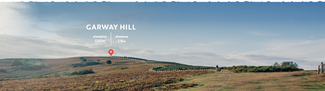
2. Garway Hill
The Peak: Just 20 minutes from Hereford, this rugged Easy Peak feels a world away. Follow wide, grassy paths on a gentle ascent, sharing the unspoiled landscape with wild ponies. At the summit, spectacular views stretch across as far as the Bristol Channel. It’s an idyllic spot for a picnic too, so be sure to pack provisions.
Recommended for: Baby-carriers / Families
Route Length: 1.8 Miles

East Herefordshire
3. Black Hill
The Peak: With the Black Hill carpark as your starting point, this route gets straight into the action on the Herefordshire side of the Malvern Hills. Follow the steady, gentle gradient, surfaced path until spectacular panoramic views reveal themselves. Pause at benches along the way. An officially designated 'Easier Access Trail' route.
Recommended for: Wheelchairs / Seniors / Hiking Beginners
Route Length: 0.2 Miles
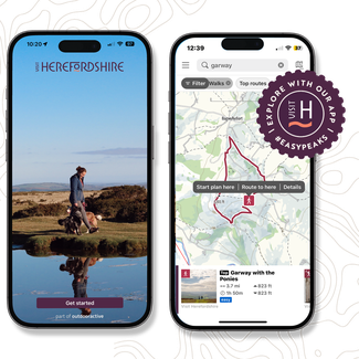
Find your perfect route
Whether you need wide, gentle paths for a tramper or a smooth surface for a push-chair, our new app gives you the full picture in advance. Download high-quality offline maps, check accessibility details, and explore the County with ease.
Easy Strolls & Sights
Prefer to stay on the level? These easily manageable routes taking in some of the County’s best-loved landmarks, all at a leisurely pace (complete with suggested pitstops!).
South Herefordshire
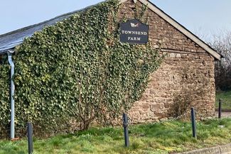
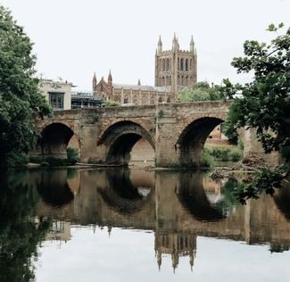
Wye Valley Willow Walk
A peaceful 4-mile amble along the fringes of Townsend Farm and the banks of the River Wye. Follow the historic dismantled railway for a mud-free alternative route.
Recommended for: Families / Strollers
Sights: The River Wye / Ross-on-Wye
Pitstop: Townsend Farm Honesty Shop
South Herefordshire
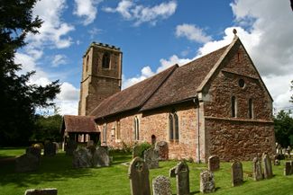
Cradley & Manton
On this gentle, barrier-free walk, marvel at Norman archways, medieval sundials, and ancient churches. An officially designated ‘Miles Without Stiles’ route.
Recommended for: Walking Disability / Wheelchair Users
Sights: St James the Great Church / St John the Baptist Church
Pitstop: The Village Store (Cradley)
East Herefordshire
Eastnor Deer Park
Wander through 300 acres of spectacular, vehicle-free parkland in this designated Area of Outstanding Natural Beauty. Enjoy a truly picturesque, accessible stroll along peaceful paths and make sure you keep your eyes peeled for the resident herd of red deer.
Recommended for: Families / Trampers
Sights: Eastnor Castle
Pitstop: The Woodshed Cafe
Monmouth to Symonds Yat is one of my favourite routes in the Wye Valley. On lower energy days, I just do part of the route, starting at either end and turning back when I need to.
The Accessible Directory
Browse our hand-picked guide to the local hotels, restaurants, and facilities that champion accessibility, making it easier than ever to explore the County with confidence.

Kaya at Blackhill Farm
This luxury, adults-only off-grid glamping site offers step-free yurt access via gentle ramps, spacious interiors for manoeuvrability, and a roll-in outdoor shower. You can even stargaze from a fully accessible outdoor bath.

The Courtyard
Experience barrier-free culture at the County’s award-winning theatre. It is truly open to all, offering full wheelchair access, a Changing Places toilet, tactile maps, hearing loops, BSL-signed shows, and sensory-friendly ‘Relaxed Performances’.

Newton Court
This quintessential Herefordshire cider farm, restaurant, and cafe offers superb level access and ample space to manoeuvre around the modern, airy space. An accessible way to experience the County's famous cider culture and enjoy an award-winning lunch.
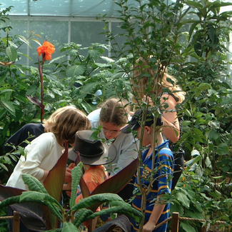
Wye Valley Butterfly Zoo
If you’re looking for a fun barrier-free day out, the butterfly zoo is ground-floor only and fully wheelchair-friendly, and there’s an accessible miniature golf course right next door! There’s a RADAR-key hoisted accessible toilet on-site, too.

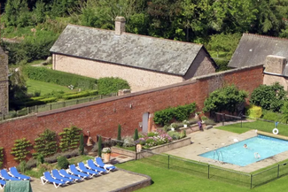
Sharpnage House
With level-access entry and spacious internal corridors designed for ease of movement, this stunning holiday let has accessibility needs covered. There's accessible bathroom facilities and dedicated blue badge parking, plus, it won the Visit Herefordshire Accessible & Inclusive Tourism Award 2025.

Wye Knot Community
Providing an outstanding range of activities and regular workshops in the outdoors designed to promote community and connection to all ages and abilities, all in a magical setting. It's well worth looking at what events they have running during any Herefordshire stay.

Tre-Vern
This modern barn conversion combines luxury with thoughtful accessibility, featuring level-access throughout the ground floor. It boasts a specially designed accessible bedroom with a private wet room, and an open-plan kitchen-dining area with ample manoeuvring space, ensuring communal living is inclusive and barrier-free for all guests.
Uncover Britain
Their award-winning online travel guides make exploring Herefordshire’s historic hotspots hassle-free. Personalised Itineraries highlight step-free attractions, accessible parking, and gentle-paced routes tailored for older travellers or those with mobility needs, empowering everyone to explore our county with confidence and independence.

The Bank
This purpose-built, tranquil lakeside retreat in Preston-on-Wye sets the gold standard for accessible accommodation. There’s level access throughout, sliding doors onto a wrap-around balcony, a lowered-surface kitchen, profiling beds, and a ceiling track hoist linking the bedroom to a fully equipped wet room.

Grange Court
This historic timber-framed building, dating back to 1633, is surrounded by a wheel-friendly tarmac path and features automatic doors, large accessible toilet, and a lift to explore the historical upper floors. After looking around, be sure to stop by our ground-floor cafe for a well-deserved treat!

NT Berrington Hall
This 'Capability' Brown designed parkland and historic Walled Garden features step-free access to the gardens, courtyard, and tearoom. They also offer free mobility scooter and tramper hire, plus an accessible shuttle buggy to get you around the wider estate!
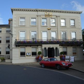
View Castle House Hotel
The ground-floor Cavalier Suite at this boutique hotel is specially adapted for wheelchair users, featuring a ramped entrance, widened doors, lowered wardrobes and sinks, and a walk-in wet room with handrails and a panic button. French doors open onto a private terrace with level access to the gardens and Waterside Restaurant.

Looking for further accessibility support in Herefordshire?
Accessible Herefordshire
Launched in 2022 by local directors Angela and Vicky, this fantastic team uses their own lived experiences to make our beautiful County more inclusive for everyone. Whether you’re a visitor looking for the best spots to explore, a resident wanting to get out and about, or a local business aiming to welcome all customers, Accessible Herefordshire is your go-to resource.
Accessibility Equipment
These are businesses and organisations that offer accessibility equipment in the County: